A team investigating the Durupınar formation in eastern Turkey, long claimed by some to be the resting place of Noah's Ark, has produced a 3D-printed model of the site built from ground-penetrating radar data, after completing the first phase of drilling more than 60 feet underground.
What's actually new
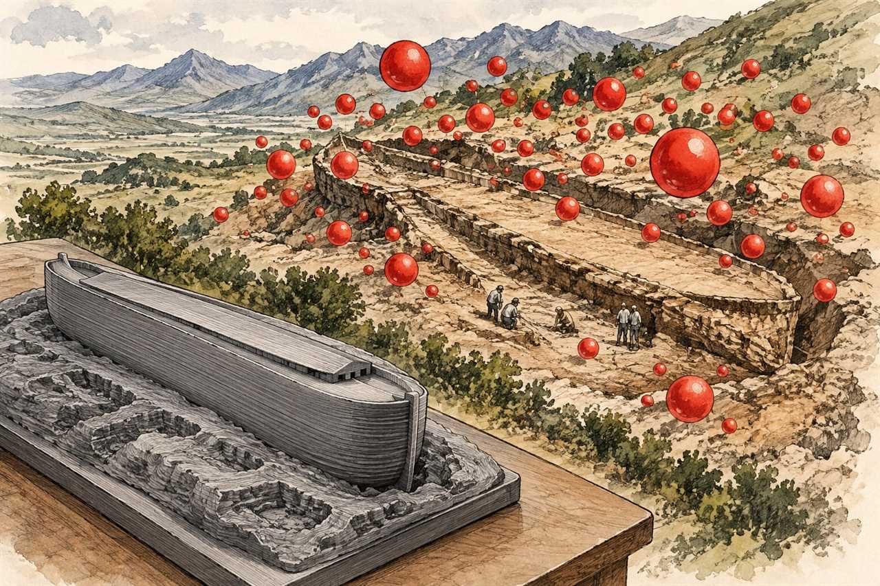
The genuinely new development here is modest and fairly dry: an architectural mapping company called FieldTech, working with the Noah's Ark Scans team, has turned radar and geophysical survey data into a physical scale model of the Durupınar formation as it currently sits beneath the ground. The formation itself is a boat-shaped feature about 157 metres long, located roughly 29 kilometres south of Mount Ararat, and it has attracted Ark theorists for decades because of its shape and rough dimensions.
What the model shows, according to FieldTech's own description, are red bubbles marking underground voids picked up through geophysical analysis. That is it. The company has been upfront that this is a visualisation of scan data and nothing more. It does not demonstrate that the formation was built by anyone, and it does not show the remains of a vessel of any kind, biblical or otherwise.
The other concrete fact is that the research team has finished the first phase of its field investigation, which involved drilling over 60 feet below the surface and collecting samples. Those samples are now set for laboratory analysis, with researchers looking for any sign of human activity or decayed wood. Andrew Jones, vice-president of the Noah's Ark Research Project, told Fox News that testing would happen this winter, saying plainly that the point is to see whether there is anything that suggests man-made activity or decayed timber. That is a reasonably modest, testable claim, and credit where due, it is the kind of statement that can eventually be checked against actual lab results rather than vibes.
Everything else circulating around this story is marketing dressed as discovery. A rendered model with highlighted voids is not evidence of a structure. It is a way of making radar data legible to people who are not geophysicists, which is a fine thing to produce, but it should not be confused with proof. The article summarising this project is careful to say so itself: the visualisation does not establish that the site is man-made or that it contains a biblical vessel. I have sat through enough breathless launch announcements in archaeology and adjacent fields to recognise the pattern, and a pretty 3D print of radar anomalies is exactly the sort of thing that gets oversold in a press release and undersold in the actual data. Nothing here moves the needle on the central question, which remains whether anything buried at that site was built by human hands.
What we don't know yet
The honest answer is almost everything that would actually settle this. The laboratory analysis of the drilled samples has not happened yet. Jones himself says the testing is scheduled for this winter, which means as of now there is no result to report, only an intention to look. Whether the samples contain decayed wood, worked material, or simply rock and sediment consistent with a natural formation is unknown.
We also don't know what, specifically, the red bubbles in the radar model correspond to underground. Voids can mean many things in geology, from natural cavities to erosion patterns to, in theory, something built. The survey data alone cannot distinguish between those possibilities, and nobody involved claims it can.
There is also the matter of Lauren Witzke, the team's director of marketing and fundraising, who posted from the site in September suggesting that the drilling results could rewrite university curricula and dismantle what she called Darwinism, describing the location as where creation began anew. Those are her characterisations of what the findings might eventually mean, not findings themselves. Nothing reported so far, including the model, touches evolutionary science in any way, and no data has been presented that disproves anything about it. It is worth separating her marketing language from the actual state of the investigation, because the two are not the same thing, and conflating them is how modest radar scans turn into headlines about overturning science.
Finally, independent verification is absent. The piece notes, correctly, that any claims about the site's origins would need evidence that outside experts can examine and confirm. That has not happened yet. Many geologists already regard the Durupınar formation as a natural feature, and a radar model with some underground voids does not change that assessment on its own. A boat-shaped outline in the landscape is not unheard of in natural rock formations, and resemblance is not proof of origin.
Who should care and who can ignore it
If you follow Ark search stories as a matter of personal interest or faith, this is a legitimate update: drilling has happened, samples exist, and a testing timeline has been given for this winter. That is more concrete than a lot of what circulates in this space, and it is fair to note the team has actually gone out and drilled 60 feet into the ground rather than simply speculating from satellite photos.
If you are waiting for an actual answer to the old question of what the Durupınar formation is, there is nothing to see yet. The model is a nice piece of visualisation work and nothing more. Save your attention for whenever the lab results on those samples come back, because that is the point at which there will be something to actually evaluate rather than render. Until then, this one sits firmly in the category of promising setup with no payoff, and I have seen enough of those to know the difference between a finding and a preview of one.